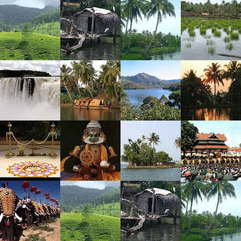
Periyar- The Longest river in Kerala
Periyar (meaning: big river) is the longest river and the
river with the largest discharge potential in the Indian state of Kerala. It is
one of the few perennial rivers in the region and provides drinking water for
several major towns. The Periyar is of utmost significance to the economy of
Kerala. It generates a significant proportion of Kerala's electrical power via
the Idukki Dam and flows along a region of industrial and commercial activity.
The river also provides water for irrigation and domestic use throughout its
course besides supporting a rich fishery. Due to these reasons, the river has
been named the "Lifeline of Kerala". Kochi city, in the vicinity of
the river mouth draws its water supply from Aluva, an upstream site sufficiently
free of seawater intrusion. Twenty five percent of Kerala's industries are
along the banks of river Periyar. These are mostly crowded within a stretch of
5 kilometres (3 miles) in the Eloor-Edayar region (Udhyogamandal), about 10
kilometres (6 mi) north of Kochi harbour.
The Periyar has a total length of approximately 244
kilometres (152 mi) and a catchment area of 5,398 square kilometres (2,084 sq
mi), of which 5,284 square kilometres (2,040 sq mi) is in Kerala.
Sources
The source of the Periyar lies high in the Western Ghats. It
is variously claimed to be located in Kerala and in the neighbouring state of
Tamil Nadu. The state of Kerala has asserted during the hearings on the
Mullaperiyar issue in the Supreme Court of India that the Periyar originates in
Kerala, flows entirely through Kerala and joins the sea in the Kerala. This has
also been admitted by the state of Tamil Nadu in the court. The source of the
river lies in the remote forests of the Periyar Tiger Reserve.Various sources
indicate the origin of the river to be Chokkampatti Mala, a peak on the
southern boundary of the Periyar Tiger Reserve.
There are alternate claims for a Tamil Nadu origin,
indicating that the Periyar originates in the Sivagiri peaks of Sundaramala,
Tamil Nadu. However, the Supreme Court of India in its judgement on the
Mullaperiyar issue in 2014, made it clear that Tamil Nadu is not a riparian
state of the river Periyar.
Journey
In its early course, the river flows in a narrow north
sloping valley starting from the Chokkampatti hills and extending north about
25 kilometres (16 mi), with a number of sharp lateral ridges running down to it
from east and west.] After flowing 48 kilometres (30 mi) from its origin and on
reaching Mount Plateau at its eastern end, it is joined by the west-flowing
Mullayar—an important tributary—at Mullakudy.During this journey the Periyar
traverses through the Periyar Tiger Reserve, flowing across or forming the
boundaries between various sections of the reserve. Going downstream, it
defines a part of the border between Periyar section of the reserve in the east and Sundaramala
section in the west and then the borders between Moolavaigai and Thannikudy sections in the east and Ummikuppan,
Mlappara and Aruvioda sections in the west before reaching the
Periyar Lake.
The Mullaperiyar dam is constructed at the confluence of the
Periyar and Mullayar to create the Periyar Thekkady lake and reservoir, as well
as the Periyar National Park. The area belonging to Tamil Nadu in the Periyar
basin is located far down the river from the Mullaperiyar Dam site.This area is
drained by the tributary Nirar, which is diverted to Tamil Nadu as a part of
inter-state Parambikulam-Aliyar Project (PAP) agreement.
From Periyar Thekkady lake and reservoir, some water is
diverted eastwards to Tamil Nadu via a tunnel. The diverted water, after power
generation, is let into the Suruliar river (a tributary of the Vaigai River)
thereby resulting in an inter-basin transfer of water. Downstream of the
Mullaperiyar dam, the Periyar continues to flow northwestward for 35 kilometres
(22 mi), exiting the Periyar Tiger Reserve and passing through Vandiperiyar,
Elappara and Ayyappancoil to the Idukki reservoir formed by the Idukki,
Cheruthoni and Kulamavu dams. The Idukki dam is constructed across the Periyar
river on the famous Idukki gorge formed by the Kuravan and Kurathi hills.
The main Periyar below the Idukki reservoir flows due north
parallel to the western edge of the Idukki plateau and is joined by the
Perinjakutty from the east and Muthirapuzha from the north. After the
confluence with Muthirapuzha, the river flows northwestwards and enters
Ernakulam district at Neriamangalam. It is joined by its major tributary, the
Idamalayar, 1.5 kilometres (0.9 mi) upstream of the Bhoothathankettu barrage.
After receiving the waters of the Idamalayar river, the Periyar flows west
along the midlands of Ernakulam district.
At Aluva, the river bifurcates into the Marthandavarma and
the Mangalapuzha branches. The Mangalapuzha branch joins Chalakudy River and
empties into the Lakshadweep Sea at Munambam, and the Marthandavarma branch
flows southwards, again dividing into two near Kunjunnikkara island, going through
the Udhyogamandal area and finally draining into the Cochin backwater system
(part of Vembanad Lake) at Varappuzha. The Vembanad backwaters are connected to
the Lakshadweep Sea at Cochin and Kodungallur.
Its major tributaries are:
Muthirapuzha River
Mullayar River
Cheruthoni River
Perinjankutti River
Edamala River
Minor tributaries are: Muthayar, Perunthuraiar, Chinnar,
Cheruthony, Kattappanayar
Although the Chalakudy river in strict geological sense is a
tributary of the Periyar, for all practical purposes it is treated as a
separate river by Government and other agencies. Chalakudy river itself has a
catchment area of 1,704 square kilometres (658 sq mi), with 1,404 square
kilometres (542 sq mi) in Kerala and 300 square kilometres (120 sq mi) in Tamil
Nadu.


